Daily
Hydrodynamics Forecast
27/ 7/ 2026
Kuwait current time is 17: 58
Tidal Current Information!!
| Location | Speed (cm/sec) | Direction (deg) |
| K.I.S.R. | 40.98 | N |
| Ras Al-aradh | 13.52 | SE |
| Kubbar Island | 6.95 | N |
| Al-Kiran Coast | 19.05 | N |
Signficant Wave Hieght Information!!
Moderate Hazard
High Hazard
| Location | W.H.(cm) | W.D.(deg) | W.P.(sec) |
| K.I.S.R. | 36.96 | SE | 2.4 |
| Ras Al-aradh | 86.28 | SE | 3.5 |
| Kuwait Bay | 61.44 | SE | 3.08 |
| Kubbar Island | 132.24 | SE | 4.46 |
| Fialaka Island | 73.32 | SE | 3.6 |
| Al-Kiran Coast | 124.92 | SE | 4.3 |
Kuwait Metrological Information!!
| Wind Speed | 32.4 kmh |
| Wind Direction | North West |
| Air Temperature | 47 C |
|
The C.I.S. System provide useful information to scientists, engineers and general public on coastal
application and hydrodynamic conditions for the Kuwaiti territorial waters.
One of the main purposes is to provide online a solution for coastal Engineering application,
Oil spill application and daily hydrodynamic forecasting of some of the important oceanographic
parameters of Kuwaiti coastal waters and the Arabian Gulf water.
|
Kuwait RealTime HydrodynamicVirtual Monitoring System (Khydro System 2008)
Khydro system was developed by (Al-Salem K., 2008) for hydrodynamics virtual monitoringin real-time
for Kuwaiti territorial waters, it is an efficient and easy-to-use system. Although more advanced
features are anticipated to evolve in the future, this version is sufficiently user-friendly and
can provide and displays highly detailed output of hydrodynamics virtual monitoring information in real-time
for Kuwait Water’s.
PREDICTION OF NEARSHORE WAVE CONDITIONS FROM IRREGULAR DEEP WATER WAVES.
(NShore Model (2022))
NShore model presents state-of-the-art NearShore wave prediction from irregular deep water wave techniques
developed by [Al-Salem K. 2022]. Methods for estimating nearshore irregular wave conditions for the case of
continuously shallowing bottom contours, given the bottom slope and offshore wave characteristics, are presented.
The methods are based on the work of Goda (1975a, 1975b) and Goda, Takayama, and Suzuki (1978).
Digital Atlas for Analysis the Inundation Effect from Sea Level Rise Scenarios on Kuwait Coastline.
(Q8SR Model (2020))
[Al-Salem 2020] has created a new Digital Atlas to analyze the inundation effect of sea level rise on
Kuwait's coastline. The impacts of global warming are causing an increase in the level of the world's
oceans, known as sea level rise.
As a result, global ocean levels are rising. Global warming has a significant impact on land-based ice,
such as glaciers and ice sheets. Kuwait's coastline, which stretches over 500 kilometers and includes both
open and enclosed bays, is exposed to a variety of natural dangers, as increasing sea levels due to global
climate change. According to the IPCC (2014), sea level rise might reach 1.0 m by 2100.
Oceanographic Atlas for Kuwaiti Territorial Waters.
(Coastal Information System [CIS 2008])
Marinas, harbours, ports, power plants, and other projects are being constructed or planned along the shoreline
of Kuwait. Such projects require data on the water levels, the currents, and the extreme wave conditions for the
design of the coastal structures. The risk associated with different extreme wave, wind and extreme water level
conditions is also essential for the proper design of coastal structures. All data was stored in a digital
Oceanographic database (Coastal Information System – C.I.S.) developed by [Al-Salem 2008] in visual Fortran,
Basic, GS script for Graphic and Active Server Page script (aspx) to provide a user friendly tool for data
extraction, data analysis and visualization. The Oceanographic Atlas of C.I.S. provides a valuable source of
data that covered All Arabian Gulf Waters from 1979 to 2021 hourly Stored
For more information Link to website address:
(http://www.hceatkuwait.net/request/C.I.S-Interface-Manual.pdf)
(http://www.hceatkuwait.net/request/HCA-Manual.pdf)
Evaluation Of Tsunami Hazards Along Kuwaiti Coastline Due To EarthQuake And LandSlides
( TUnami-N2KISR Interface(2017))
A Digital Evaluation for three major tectonic faults in the Arabian Gulf region. It was found that only
one fault, the Makran Subduction Zone (MSZ), situated outside the Arabian Gulf can potentially cause
the submarine earthquake induced tsunami. The earthquakes between the magnitudes of Mw 8.3 and Mw 9.0
at MSZ were studied.
Also Simulated tsunami generated by coastal landslides (seismically triggered by earthquakes).It is
worth noting that this study for the first time investigated this phenomenon in this region. In fact,
the biggest coastal landslide in the world occurred inland in the region. The landslide is known as
the Saidmareh landslide (Shoaei and Ghayoumian 1998) with an estimated volume of the landslide to be
approximately 20 km3.
Also evaluate Kazerun-Qatar Fault System (KFS) as [Hypothertical Scenario Case].
The Kazerun-Qatar fault system is a north-trending dextral strike-slip fault zone in the Zagros mountain
belt of Iran as shown in the following Figure. It probably originated as a structure in the Panafrican basement.
Prediction of Longshore Currents and Sediment Transport (KLSC Program 2021)
KLSC Program was developed by (Al-Salem K., 2021) for prediction of longshore currents and
sediment transport. When waves break at an angle to a beach they generate a longshore current
flowing parallel to the shoreline and confined largely to the nearshore zone. This current, in
turn, interacts with the waves to produce a longshore sand transport. A numerical model for the
steady-state profile of the longshore current induced by regular, obliquely incident, breaking
waves will be presented. The wave parameters must be given at an arbitrary depth. A rapid convergent
numerical algorithm is described for the solution of the governing equation. This model is solved
using a nonlinear bottom friction law in which the friction coefficients are a function of the
bottom roughness which is computed at each point using an empirical formula. The purpose of this
study is to present a numerical model of longshore current in combination with some of the known
formulae for predicting sediment transport which can be used for engineering purposes.
For more information
[ http://www.hceatkuwait.net/KLSC/LongShore-Current-Report.pdf ]
DETAILS DESIGN FOR BREAKWATERS [GROINS] STRUCTURE (KBwater Program 2021 )
KBwater Program was developed by (Al-Salem K., 2021) for Breakwater Structure design.
The rubble structure is normally composed of a bedding layer and a core of quarry run stone
covered by one or more layers of large stones and an exterior layer or layers of quarrystone (armor)
or concrete armor units. This breakwater is exposed to wave actions on one side ( Seaside) and
intended to allow minimal wave to the lee-side. Breakwaters of this type are usually designed with
crests elevated such that overtopping occurs only in very severe storms. If it is exposed for
substantial wave action from both sides (Example: outer portions of jetties). The recommended cross
section takes into account some of the practical problems involved in constructing submerged features.
Annual LongShore Sediments Transport For Kuwait and Arabian Gulf Waters ((KSED Model 2020))
KSED model was developed by (Al-Salem K., 2020) to predict Annual longshore sediment transport rate and its
cross-shore distribution in the surf zone are essential to many coastal engineering and science studies.
Practical engineering applications such as beach response in the vicinity of coastal structures, beach-fill
evolution and re-nourishment Requirements, and sedimentation rates in navigation channels all require accurate
predictions of longshore sediment transport rates. Formula proposed by Kamphuis (1991), which includes wave period,
a factor that influences breaking, gave good estimates. Arguably the most widely used model for estimating
total longshore sediment transport rate is the “CERC” formula (Shore Protection Manual, 1984).
The model was based on the assumption that the total longshore sediment transport rate is proportional to longshore
energy flux
( )
Numerical model for Drifting Floating Object in Arabian Gulf Water’s ( KDrift Model (2019))
A Numerical model for Drifting Floating Object in Sea was developed By [Khaled Al-Salem 2019].
For Searching and rescue of persons or floating Object in distress on the high seas requires the
capability to accurately predict the position of the survivors or to locate the object. The current
approach used to predict the drift is based on an empirical correlation between wind speed and search
object motion derived from available field data [2D tidal current predicted from KGluf Model and wave
height Predicted from KWave Model (K. Al-Salem 2009 and 2005)].
Subsequently, the model was simplified for operational use in search and rescue mission planning for
disabled boats and drifting life rafts
Digital Hydrodynamics' Forecast for Kuwait Water's (DHF system 2009)
DHF is an Operational forecast systems provide hourly nowcasts and short-term (one day) forecasts that are updated
every 24 hours of water levels and currents, wave height, wave period, wind speed and air temperature. Because these
predictions are based on a hydrodynamic model, they are considered to be computer-generated forecast guidance.
System developed by (Alsalem K. 2009)
Global Tide Level Prediction Model (Global KTide Model)
Global KTide model was developed by (Al-Salem K., 2011) for Global Water Level Prediction; This version is sufficiently user-friendly
and can provide the base information for water tide elevation for Global Regions (Asia, Africa, Europe, North America
and South America). The information provided by this model can be further used to calculate sediment/pollutant
transport and used as input for tidal circulation models.
Kuwait Tide Level Prediction Model (Ktide Model)
Tide model Model was developed by (Al-Salem K., 2004) for Kuwaiti territorial waters and the Arabian Gulf , it is an efficient
and easy-to-use model. Although more advanced features are anticipated to evolve in the future, this version is sufficiently
user-friendly and can provide the base information for water tide elevation for Kuwait Waters and the Arabian Gulf. The information
provided by this model can be further used to calculate sediment/pollutant transport and to predict the tidal circulation for
Kuwait waters and Arabian Gulf.
Arabian Gulf 2D Tidal Current and Water Level Prediction Model (KGulf Model)
New Version of Combined 2D Tidal Current and Tide Level Predictions for Kuwait and Arabian Gulf Water.
Named as KGulf Model (developed by Al-Salem K., 2009) using the tidal constituents for tidal current and water Level
in the x (east) and y (north) directions were calculated for total wet grids of 3692 nodes which covers all Arabian Gulf Waters.
Kuwait Tidal Current Predictin Model (Kcurrent Model)
A tidal Current Model were developed for Kuwaiti Water and Arabian Gulf named as KCURRENT Model (developed by Al-Salem K., 2005) using
the tidal constituents for the tidal currents in the x (east) and y (north) directions were calculated. Based on the amplitude and
phase for these constituents (22 constituents were used), it is possible to predict the tidal currents at the locations where the
constituents were determined.
Back Tracking of Oil Slick Movements in Offshore of Arabian Gulf Marine Waters (BOil Model (2013))
A Numerical model has been developed based on the solution of the governing partial differential equations of flow
and immiscible pollutants (BOil) for predicting the back track oil slick in Kuwaiti offshore territorial waters
and Arabian Gulf waters. The model has been coupled with KGulf Model, a hydrodynamic numerical model (K. Al-Salem, 2012).
This velocity distribution will be taken as the input for back tracking oil transport simulation model.
The Lagrangian discrete parcel algorithm has been used to predict the back oil spills and the model consider Monte Carlo
Statistical technique to overcome the random walk in Lagrangian discrete parcel algorithm.
It can be used either as a real-time basis to predict the back movement of oil spill for unexpected accident of
crude carriers in the Kuwait offshore waters or for Quick respond for decision marker on any oil spill accidents in the sea.
OIL SPILL Trajectory Model for Arabian Gulf waters (KOil Model(2012))
KOil is A Numerical model based on the solution of the governing partial differential
equations of flow and immiscible pollutants (Oil) for predicting the oil slick drifting in
Kuwaiti territorial waters and Arabian Gulf waters (K Al-Salem 2012).
The model has been coupled with KGulf Model, a hydrodynamic numerical model(K. Al-Salem 2009). KGulf
gives the 2D velocity distribution on the surface of water body and in the case of transient analysis; the
velocity distribution is calculated at each computational time step. The Lagrangian discrete parcel algorithm
has been used to predict the oil spills and the model considers various processes including advection, mechanical
spreading and evaporation. It can be used either as a real-time basis to predict the movement of oil spill
or as a scenario model to analyzes the possible impact of accidental oil spill.
KOil model not only simplifies the modeling process but also provides in-depth analysis
in overcoming environmental problems. This is because of the fact that different
Simulation sites can very easily be accommodated in the computational model
Kuwait OIL SPILL Model (KOil Model (1993))
The Kuwait OIL SPILL model(KOil Model), developed by Khaled Al-Salem (1993) was updated by including an Active Server Pages (ASP) technology for internet.
The model produces the tidal currents from the KCURRENT model described earlier. The model can run in statistical or deterministic mode.
The deterministic mode Can use both Constants wind data or Realtime Metrological Data For Max. Of 6 days hourly wind data.
The statistical mode is based on historic wind data and determines the areas that might be affected by a certain oil spill and the
probability of occurrence.
Under Water OIL Seepage Model (KSPoil Model)
The Prediction of Natural Oil Seepage For Kuwait Water's and Arabian Gulf (KSPoil Model), Updated by Khaled Al-Salem (2010) and including an Active Server Pages (ASP)
technology for internet. The model produces the tidal currents from the KGulf model described earlier.
The model can provides a description of movement of the oil over the water column.
It considers the thermodynamics and hydrodynamics of the plume. The simulation model considered two phases of an oil plume. a hlep report is inculded for user.
KISR OIL SPILL Model (K.O.S. Model)
The KISR OIL SPILL model, developed by K. Al-Salem and Lo (1993) was updated by including an Active Server Pages (ASP) technology for internet version as: http://hceatkuwait.net/oil/oilsurf/kuwoil.aspx .
The model produces the tidal currents from the KCURRENT model described earlier. The model can run in statistical or deterministic mode.
The statistical mode is based on historic wind data and determines the areas that might be affected by a certain oil spill and the
probability of occurrence.
Arabian Gulf OIL SPILL Model (A.G.O.S Model)
The Arabian Gulf OIL SPILL model was developed by (Al-Salem K., 2007). This model
was updated and extended model from the KISR OIL SPILL
model which was described earlier in this section. An Active Server Pages (ASP) technology was developed for internet. To link to the model
through the internet is http://hceatkuwait.net/Oil/gulfoilspil/gulfoil.aspx
Kuwait Wind-Wave Prediction Model (Kwave Model)
KWAVE model was developed by (Al-Salem K., 2005) to predict the significant wave height and period from wind data for the Kuwaiti
territorial waters and the Arabian Gulf. An empirical model is developed for the Kuwaiti territorial waters to provide an efficient
prediction of wave parameters. This technique can be useful in providing approximate wave conditions from wind data.
It is expected that the technique can provide good predictions for storm conditions. For swell conditions, it will not provide
good results. Due to the relatively small water body of the Arabian Gulf in most cases the wind will not vary considerably over
the full Gulf.
Wave Agitation Prediction Inside A Harbor (KHarbor Model)
Construction of a new harbor or the changes of harbor layout or selection of the type of breakwater has to be preceded by a detailed
analysis of wave agitation inside a harbor and the analysis of wave interaction with harbor structures. Such analyses are necessary wave
climate inside the harbor basins and to find out the conditions for harbor resonance. KHarbor Model was Developed by Al-Salem K. 2009.
Extreme Storm Surge for Kuwait Water's (KSurge Model)
The extreme water level at any location is an important parameter required for the proper design of a coastal structure. Storms are atmospheric
disturbances characterized by low pressures and high winds. A storm surge represents the water surface response to wind-induced surface shear
stress and pressure fields. Storm-induced surges can produce short-term increases in water level that rise to an elevation considerably above mean
water levels. A KSurge Model was developed by (Al-Salem K., 2009) to predict the the extreme storm surge at Kuwait Coastal line.
Ps. The Model is slow in downloading Map.
For Mobile Cellular Phone ver(1.0) download : )
Gaussian Pollutant Concentration dispersion for Mobile Cellular Phone ver(1.0) ()
KBLUM model can be used to estimate level concentrations of pollution coming from a source of pollution.
You can investigate how the changes of the meteorology (e.g. wind speed and stability) affect plume spread or
how source characteristics such as stack height and emission rate affect the concentrations at downwind and
the level of concentrations above the ground by using Gaussian Source Plume Method Developed by (Khaled Al-Salem, 2010).
Free Download for Mobile Cellular Phone ver(1.0).
Krose program for plotting rose charts (Krose)
The KROSE program tool was developed by (Al-Salem K., 2006) . This tool can be used to present output for wave
height generated from KWAVE model; output generated from KCURRENT model or user data can be uploaded to be plotted. An Active Server
Pages (ASP) technology was developed for internet.
Universal Transverse Mercator & Geographical System Conversion (Kutm Soft.)
Convert geographic coordinates!.
Kutm can Converts geographic coordinates between UTM, Longitude/Latitude by using datum WGS84 , NAD27 / NAD83,
and more... almost all projections and datum's on Earth are supported. You can convert single coordinates,
or coordinates between two locations and calculate the distance. Developed by (Al-Salem Khaled 2009).
|

Mobile Hydrodynamic

Mobile BarCode
Scane/Design
DownLoad
Information
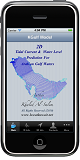
Mobile KGulf
2D Hydrodynamin's Prediction for Arabian Gulf Waters On Mobile Cellular Phone.
DownLoad
Information
Mobile KTide
Tide Prediction software On Mobile Cellular Phone.
DownLoad
Information

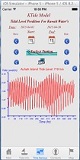
Mobile KForc
Kuwait Weather & Sea Hydrodynamic's Forecast On Mobile Cellular Phone.
DownLoad
Information

Mobile Q8Brod
نشره الأرصاد البحرية لدول مجلس التعاون الخليجي
To listen to live interactive audio stream for online water hydrodynamics' On Mobile Cellular Phone.
DownLoad
Information

Mobile KOil
KOil Numerical Prediction of Oil Slick Movement in Kuwait Waters On Mobile Cellular Phone.
DownLoad
Information

Mobile BOil
تتبع مصدر تسرب النفطي في مياه الخليج العربي
Predicting the back track oil slick in Kuwaiti offshore territorial waters and Arabian Gulf waters On Mobile Cellular Phone.
DownLoad
Information

Mobile Q8CIS
1D Hydrodynamic's Prediction for Arabian Gulf and Global Water Level Prediction On Mobile Cellular Phone.
DownLoad
Information

Mobile KSurge
Extreme Water Level Prediction Due to Storm Surge, Wave setup and Water level for Arabian Gulf Water's on Mobile Cellular Phone.
DownLoad
Information

Mobile KPlum
Gaussian Air Pollutant for 2D Dispersion Prediction on Mobile Cellular Phone.
DownLoad
Information
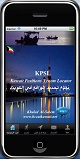
Mobile Q8Sea
Kuwait Sea.
DownLoad
Information
|
|
|