
IPhone Apps. Released at Apple Store.
|
Q8Home It is a house construction cost app [ تطبيق تكلفة بناء المنزل ]
NOT Released At Apple Store |

|
|
Mobile Total Station [ عبر تطبيق الهاتف ]
NOT Released At Apple Store |
|
|
خدمه الكترونيه لتقديم شكوي بيئه
|

|
|
Kuwait National Seismic [KNSN], it is a monitoring seismic activities alert for GCC cities with objectives of recording local, regional and teleseismic events as well as to assess the hazard those seismic events pose to the country. KNSN alert system work three operation system:
1-Online Internet website [http://hceatkuwait.net/KNSN.aspx]
Not Release At Apple Store |

|
|
Barcodes are widely used in product information lookup, share your contact info by QR-code and design login to a remote website. KBAR apps is Barcode /QR-code Reader provides flexible way for you to customize the scanning settings for different usage scenarios. Also you can design and create Barcode/QR-code templates with number of design settings such as:
1-Insert logo in middle of QR-code template from select image of [device photo library, or by snap shot from device
camera, or from pre-saved logo images]
Released At Apple Store |
|
|
KUnami interface adopts the setup and organized the input data for simulation Comcot model for tsunami wave prediction that covered the Arabian Gulf, Gulf of Oman and Arabian Sea. Let’s user to generate and presents the simulation output in 1D, 2D and 3D graphics; Also to generate 2D and 3D results animation by using the Surfer Software Utilities. KUnami interface also linked to the internet system for public awareness through webs ide address (http://hceatkuwait.net/KUnami/kunami.aspx) and through a smart mobile technology. KUnami Apps, It’s a mobile apps that hold the KUnami Interface awareness system for selected location in Arabian Gulf, Gulf of Oman and Arabian Sea waters. The system will hold the posted awareness data in the system by default 6 hours or more. For more information on the system go to website address: http://hceatkuwait.net/request/KUnami.pdf and apps vide at http://hceatkuwait.net/request/KUnamivid-page.htm Not Release At Apple Store |

|
|
KTrack interface adopts the setup and organized the tracking data location for back track path. Let’s user to generate and presents the simulation output in 1D location of tracking and Online Tracking for Registered Mobile apps application; Also to generate back track Location on Google maps Utilities. The KTrack apps can be contact with remote website at ( http://hceatkuwait.net/KUnami/kunami.aspx ) and through a smart mobile technology. Or Mobile to Mobile communication. NOT Release At Apple Store |

|
|
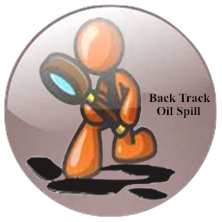
تتبع مصدر تسرب النفطي في مياه الخليج العربي
A Numerical Apps has been developed based on the solution of the governing partial differential equations of flow and immiscible pollutants for predicting the back
track oil slick in Kuwaiti offshore territorial waters and Arabian Gulf waters (BOil APPS) . The apps has been coupled with KGulf Model, a hydrodynamic numerical model
(K. Al- Salem, 2012). KGulf gives the 2D velocity distribution on the surface of water body. The Lagrangian discrete parcel algorithm has been used to predict the back
oil spills and the apps consider Monte Carlo Statistical technique to overcome the random walk in Lagrangian discrete parcel algorithm. It can be used either as
a real-time basis to predict the back movement of oil spill for unexpected accident of crude carriers in Kuwait or Arabian Gulf offshore waters and for Quick
respond for decision marker on any oil spill accidents in the sea.The Offshore back Track oil spill APPS is an efficient and interactive apps and easy to use
for any user with a little experience in a computer usage. This apps version is sufficiently user-friendly and can provide the base information for prediction
of the oil spill source and present it on navigation map will provide important information for the decision makers on actions necessary to deal with the source
of the oil spill.BOil apps developed by (Khaled AlSalem 2013).
NOT Release At Apple Store |
|
|
نشره الأرصاد البحرية لدول مجلس التعاون الخليجي
To listen to live interactive audio stream for online water hydrodynamics' prediction, weather forecasts and live Broadcast hourly updates for Gulf Corporation Council (GCC) Countries and Arabian Gulf water's.
الاستماع إلى نشره الأرصاد البحرية و الجوية لحركه المد و الجزر و التيارات البحرية لدول مجلس التعاون الخليجي ولمياه الخليج العربي
و التحديثات لنشره الأرصاد البحرية وهي بالساعة
Released At Apple Store |
|
|
GNAAS game is an enjoyable games favored by all children and adults and
that need to be a player on a great deal of precision in shooting and speed in the move
Not Release At Apple Store |
|
|
الرسائل القصيرة والمخاطبة الفورية
Swalf apps Lets user easily send SMS text messages to and from IPhones to personal computer , IPhone to IPhone or computer to IPhone to your contacts’
mobile phones Registered. Swalf apps is also great way of meeting new friends let you have public online chat with each other. Swalf Chat is designed
for real-time, unstructured conversations with users who are signed on to the site at the same time. By default, Chat messages are saved and are visible
to all users so that all site participants can benefit from clarifying conversations and questions and answers.
Swalf apps developed by (Aisha AlSalem/Khaled AlSalem 2012)
Not Released At Apple Store |

|
|
ديوان Apps is Kuwait Diwan Locator (دليل مواقع الديوانيات في الكويت) is an electronic index and a navigation system for locating a any selected Diwan in the State of Kuwait . Not Released At Apple Store |
|
|
Kuwait Positioning System Locator (Q8Sea apps) is a navigation system for Kuwait Area. This apps was setup for two option for user as:
1- For fishing area locator. This apps has about 150 fishing area in Kuwait water were stored in , also has the ability for user create his own data file and
user can get his current location recorded. Also this app can display for user the fishing area within setup distant from his current location.
2- For locating areas of interest such as Location of Shopping Center, hotels, Camping Areas, Entertainment Places, Different type of Restaurants, Wedding
Lounges and Hospitals (Public and Private) where user can navigate by the apps.
Q8SEA app can send sms or email the data with an image attached.
For Fisher, KPSL apps show daily hydrodynamic information prediction (Tide Level info.) from different station in Kuwait waters.
Released At Apple Store |
|
|
It is a mathematical simulation of how air pollutants disperse in the ambient atmosphere. It is performed with computer programs that solve the mathematical
equations and algorithms which simulate the pollutant dispersion. The dispersion apps are used to estimate or to predict the downwind concentration of air
pollutants or toxins emitted from sources such as industrial plants, vehicular traffic or accidental chemical releases.
KPlum APPs was developed by (K. Al-Salem 2011). Such apps are important to governmental agencies tasked with protecting and managing the
ambient air quality. The apps are typically employed to determine whether existing or proposed new industrial facilities are or will be in
compliance with the National Ambient Air Quality Standards. The apps also serve to assist in the design of effective control strategies to reduce
emissions of harmful air pollutants.
Not Released At Apple Store |
|
|
The Oil transport model is coupled with 2D hydrodynamic model for Kuwait Waters and Arabian Gulf (KGulf model). This model gives
the velocity distribution on the surface of water body. The velocity distribution is calculated at each
time step and is taken as an input for the oil transport simulation model (KOil model). A Lagrrangian discrete-parcel algorithm is used.
In this algorithm, the oil slick is viewed as a large ensemble of small parcels.
Released At Apple Store |

|
|
The Oil transport model is coupled with 2D hydrodynamic model for Kuwait Waters
(KGulf model). This model gives
the velocity distribution on the surface of water body. The velocity distribution is calculated at each
time step and is taken as an input for the oil transport simulation model (KOil model). A Lagrrangian discrete-parcel algorithm is used.
In this algorithm, the oil slick is viewed as a large ensemble of small parcels.
Released At Apple Store |

|
|
Forecasting Weather and Hydrodynamic's information severe as warnings and helping system for the
public to make informed decisions. KForcs APPs, Produces weather and hydrodynamic's forecasts for
Kuwait Weather and Sea condition, which help the public make informed decisions about day-to-day
activities and warn people of extreme weather to mitigate its impacts -contributing to the protection
of life in sea. KForcs App was developed by Khaled AlSalem(2011). User Need to update met files ones in
every 6 days through the internet. For more information on Kuwait and Arabian Gulf Forecast go to Website
at adders:
http://hceatkuwait.net/web_pas/main.aspx Released At Apple Store |

|
|
Prediction of tidal variations in water level is of importance in a wide range of practical applications such
as: Navigation through inter-coastal waterways, and within estuaries, bays, and harbors; fishing, etc.
Q8CIS APPs is a general-purpose, state-of-the-art water levels prediction app
developed by (K. Al-Salem 2011). It allows user to setup
station in Arabian Gulf for Hydrodynamic's Prediction. And it is capable of estimating the water level
variation due to tides at a number of stations in the Global waters. The Q8CIS app was validated with other model
for water levels prediction it was found to provide good results. Released At Apple Store |

|
|
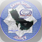
The extreme water level at any location is an important parameter required for
the proper design of a coastal structure. Storms are atmospheric disturbances
characterized by low pressures and high winds. A storm surge represents the
water surface response to wind-induced surface shear stress and pressure fields.
Storm-induced surges can produce short-term increases in water level that rise
to an elevation considerably above mean water levels. A KSurge Model was
developed by (Al-Salem K., 2009) to predict the extreme storm surge at Arabian
Gulf and Kuwait Coastal line.
Released At Apple Store |
|
|
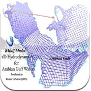
KGulf is 2D hydrodynamics Prediction model set up for the Arabian Gulf and Kuwait waters.
The model is capable of simulating 2D tidal current and water level at any selected grid inside Arabian
Gulf waters from year 1975 to 2035 with hourly output results. A grid was generated covering the Arabian
Gulf from the Hormoz inlet till the upper part of the Gulf . The grid spacing is about 5-8 km in the Arabian
Gulf with total of 3692 wet grid inside the Gulf. KGulf model was validated using a tide prediction (TIDCALC) model,
RMA-10 HD model and using some field measurements. Result showed that the model is capable of predicting the tidal currents
and water level variations well with very short simulation time.
Not Release At Apple Store |
|
|
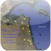
Kuwait Tide Model (KTide) is general purpose program for water level prediction. It capable to estimate water level variation due to tides at a number of station in Kuwait territorial water.KTide model was validated using measured water level data and other model results. It was found the program provided a good agreements. Not Release At Apple Store |
|
|
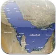
Tide Model was developed by (Al-Salem K., 2004) for Tide Level Prediction for Kuwaiti territorial waters and the Arabian Gulf , it is an efficient and easy-to-use. This version is sufficiently user-friendly and can provide the base information for water tide elevation for Kuwait Waters and the Arabian Gulf from Jan 1,1975 to Dec 31,2035 hourly data prediction. Not Release At Apple Store |
|
|
KISR Peliminary App Design [2015] on Mobile Device Not Release At Apple Store |

|